
Its objective was to produce, organise and make use of the data required to develop two digital twins:
- JANUS, dedicated to monitoring and forecasting air quality and atmospheric pollutants;
- JUNHI, focused on wetland functioning, interactions with the atmosphere and responses to environmental changes.
These two digital twins complement JUNEAU-Quant and JUNEAU-Qual, developed as part of the JUNEAU project and dedicated to groundwater resources.
Together, these tools aim to improve understanding, monitoring and forecasting of greenhouse gas fluxes and atmospheric pollutants at the soil–air–water interface, supporting regional strategies for climate adaptation, environmental health and agroecological transition.
The project contributes data, models and scientific expertise to the programme's DATA, PREDICTIONS and DIGITAL TWINS components. It also supports the development of an information system promoting interoperability and data sharing between academic and non-academic stakeholders.
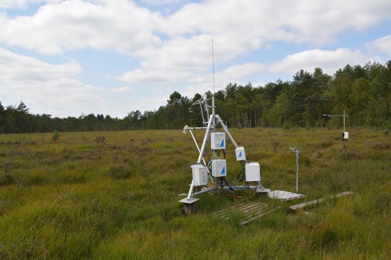
Tour à flux, tourbière de La Guette
© SNO Tourbières
Understanding atmospheric fluxes and air quality
Human activities significantly alter the chemical composition of the atmosphere. In turn, these changes affect ecosystems, biogeochemical cycles and human health, while climate change itself influences the dynamics of these compounds.
The JANUSS project aims to analyse greenhouse gas fluxes (N₂O, CO₂, CH₄), atmospheric pollutant concentrations (NH₃, O₃, NOx, fine particulate matter PM10 and PM2.5, aerosols and other pollutants with potential health impacts), and exchanges at the soil–air–water interfaces within the critical zone.
The data used come from long-term field monitoring records, in situ and laboratory experiments, and modelling activities. They are integrated, either directly or through existing models, into machine learning approaches to support the development of the JANUS and JUNHI digital twins.
Data production and organisation
JANUSS aims to generate large volumes of reliable data, ensure their long-term continuity and organise them to identify key parameters and relevant tracers.
The project relies on instrumented platforms such as PESAt, PESAa and PRAT, deployed in agricultural environments and wetlands, particularly peatlands. It also draws on satellite observations, regional research infrastructures such as the DECAP sensor development platform, and Lig'Air, the regional air quality monitoring network.
The two digital twins pursue complementary objectives:
- JANUS aims to identify sources of atmospheric pollution, improve understanding of greenhouse gas emissions and assess health risks associated with pollutants such as ammonia, fine particulate matter and ozone.
- JUNHI aims to improve understanding of wetland functioning, study their responses to climate change and explore different conservation and restoration scenarios, particularly for peatlands.
These tools are designed to support public decision-makers, local authorities and agricultural stakeholders in their strategic choices by improving the reliability of measurements and models at the regional level.
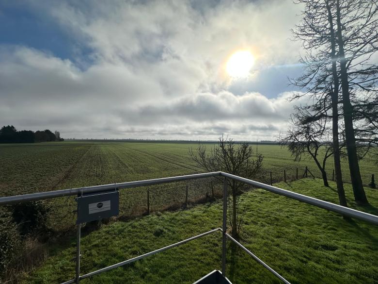
Campagne de mesure de l'ammoniac dans le département de l'Eure-et-Loir
© CNRS
The JANUS digital twin aims to improve knowledge of air quality and anticipate future changes, drawing on observational data and atmospheric models developed within the JANUSS project.
Ammonia monitoring
The project pays particular attention to ammonia (NH₃), an atmospheric compound closely associated with agricultural activities. Once emitted, ammonia can react with other atmospheric compounds to form secondary fine particulate matter, potentially affecting air quality and human health.
The objective is to better understand regional NH₃ patterns, its role in the formation of fine and ultrafine particles, and to anticipate related regulatory developments.
This work is carried out in collaboration with Lig'Air, the regional air quality monitoring organisation and a member of the Atmo France federation. Lig'Air operates a network of 25 real-time monitoring stations and develops atmospheric emissions and concentration models.
Greenhouse gas emissions: focus on nitrous oxide
Among the greenhouse gases studied in the project (N₂O, CO₂, CH₄), nitrous oxide (N₂O) is subject to particularly detailed monitoring. This gas has a high global warming potential and contributes to the depletion of the stratospheric ozone layer.
In agriculture, N₂O emissions are mainly associated with nitrogen fertiliser applications and microbial processes in soils. Improving understanding of these mechanisms is essential to supporting changes in agricultural practices.
To better quantify these emissions at the regional scale, JUNON draws on research conducted in collaboration with INRAE. This work is based on a historical dataset of N₂O measurements collected since 2009 from fertilised soils. Observations have revealed strong temporal variability, particularly in spring, linked to nitrogen applications and soil moisture conditions.
Approximately 3,000 data points collected over fifteen years have made it possible to:
- identify the main controlling factors (climate, agricultural practices, hydromorphology and pH);
- estimate regional emission factors;
- improve understanding of processes occurring at the soil–air and air–water interfaces.
The progressive automation of monitoring systems and the use of instrumented chambers now make it possible to capture fine-scale variations in greenhouse gas fluxes more accurately.
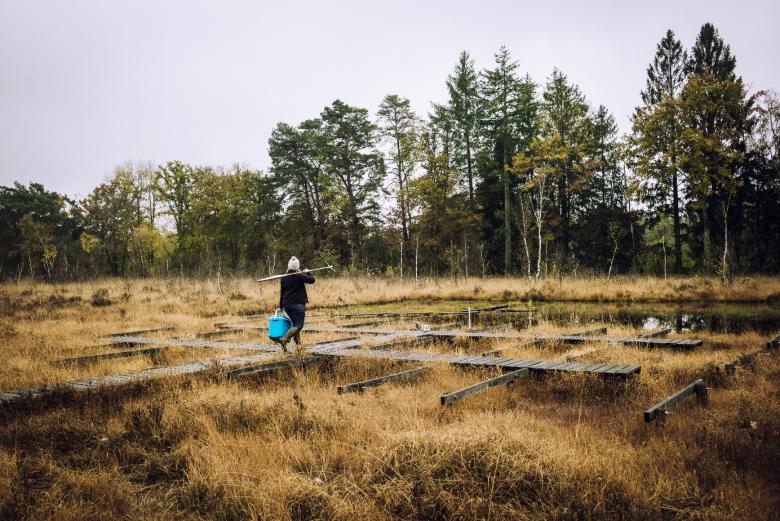
Tourbière de La Guette
© Cyril FRESILLON / ISTO / CNRS Images
The JUNHI digital twin focuses on wetland functioning, particularly peatlands, and their interactions with the atmosphere. It aims to improve understanding of their role in water and carbon cycles and to simulate their responses to environmental changes.
Greenhouse gas emissions from wetlands
Peatlands store approximately one-third of global soil carbon, while degraded or drained peatlands contribute nearly 5% of anthropogenic greenhouse gas emissions (CO₂ and CH₄).
The objective is to assess the sensitivity of carbon and water cycles in these wetlands to global climate change and local disturbances. More specifically, the project aims to better quantify CO₂ and CH₄ emissions and their associated driving factors, while identifying the role of these ecosystems in regulating the water cycle.
To achieve this, JUNHI draws on long-term hydrological, meteorological, biogeochemical and biological data collected at the instrumented La Guette peatland site (Sologne, Cher). Monitoring has been carried out since 2008 through the PESAt platform (PIVOTS regional programme), the SNO Tourbières (National Peatland Observation Service) and the ZAL (Loire Long-Term Socio-Ecological Research Platform).
These monitoring systems are associated with national research infrastructures, including OZCAR (Critical Zone Observatories: Applications and Research) and RZA (Network of Long-Term Socio-Ecological Research Platforms), as well as the European ICOS infrastructure (Integrated Carbon Observation System). The site is also a candidate for inclusion in the European eLTER infrastructure (Integrated European Long-Term Ecosystem, Critical Zone and Socio-Ecological Research).
The data produced are freely available at www.sno-tourbieres.cnrs.fr.
Satellite data and integrated modelling
The JANUSS project also uses satellite data to cover the entire regional territory and analyse atmospheric fluxes on a larger scale. This includes:
- selecting and assessing European and American datasets;
- developing automated data retrieval and processing tools;
- improving spatial resolution using appropriate mathematical methods;
- carrying out specific analyses for methane and carbon dioxide.
These data are integrated into air quality and greenhouse gas flux models, then used in the development of JANUS and JUNHI to simulate different future scenarios.
Ultimately, these two digital twins will contribute to a better understanding of interactions between human activities, the atmosphere and ecosystems, supporting environmental management across the region.
Learn more:
Project leads:

Responsable de l'équipe "Atmosphère et Environnement"
CNRS
1C av. de la Recherche scientifique
45071 Orléans
France

Observatoire des Sciences de l'Univers en région Centre (OSUC)
Institut des Sciences de la Terre d'Orléans (ISTO)
1A rue de la Férollerie - Orléans
45100 Orléans
France